Northern lights forecast tonight in Lapland
13 towns across Lapland, each with tonight's chance from NOAA's Ovation model, updated every 15 minutes. Kp is a 0 to 9 scale of how far the lights reach from the pole, and every town here needs Kp 1 before your eyes pick anything up.
Tonight the sky is dark for 7.3 hours in Hammerfest and 8.1 in Rovaniemi.
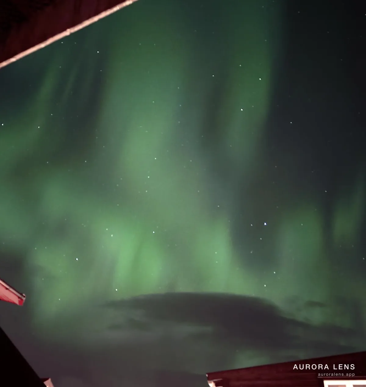
Best tonight
Abisko
No town in Lapland has a measurable chance right now. That changes when a storm arrives, so check again after dark.
Abisko sits closest to the pole in Lapland, so it needs the least: Kp 1.
🔔 Get free aurora alerts
Sign up and we'll send you one alert when a storm is coming and auroras are likely. Nothing else, ever.
We store only what's needed to send the alert. One-tap unsubscribe in every message.
Every town in Lapland tonight
| Town | Chance now | Your eyes need | Tonight |
|---|---|---|---|
| Abisko | 0% | Kp 1 | Auroras likely tonight |
| Alta | 0% | Kp 1 | Auroras likely tonight |
| Bodø | 0% | Kp 1 | Auroras likely tonight |
| Hammerfest | 0% | Kp 1 | Auroras likely tonight |
| Inari | 0% | Kp 1 | Auroras likely tonight |
| Ivalo | 0% | Kp 1 | Auroras likely tonight |
| Kirkenes | 0% | Kp 1 | Auroras likely tonight |
| Kiruna | 0% | Kp 1 | Auroras likely tonight |
| Levi (Kittilä) | 0% | Kp 1 | Auroras likely tonight |
| Narvik | 0% | Kp 1 | Auroras likely tonight |
| Rovaniemi | 0% | Kp 1 | Auroras likely tonight |
| Saariselkä | 0% | Kp 1 | Auroras likely tonight |
| Tromsø | 0% | Kp 1 | Auroras likely tonight |
Faint aurora looks gray to your eyes and green to a phone. In Lapland a phone picks it up from about Kp 1, and your eyes need Kp 1.
Aurora is possible in Lapland from late August to mid-April. The sky has to be dark and clear. Clouds stop everything, and no camera gets around that.
Where people actually stand in Lapland
Places locals and guides name, with what each one gives you. Every town below has its own page.
Abisko
Aurora Sky Station
5 km west · bus
A chairlift climbs for twenty minutes to a station at 900 metres on Nuolja, above much of the low cloud that spoils nights below. A terrace and a small viewing tower face out over the mountains, with warm overalls handed out at the base.
Abisko nationalpark
2 km north-west · walkable
The park entrance sits on the south shore of Torneträsk, and the lake leaves the northern horizon flat and unlit. Abisko's dry microclimate, the so-called blue hole, often holds a clear patch when the rest of the range is covered.
Björkliden
9 km north-west · bus
A small mountain station about nine kilometres up the lake from Abisko, with its own halt on the Malmbanan railway and very little permanent lighting. Torneträsk lies directly north, so the horizon in that direction stays low and dark.
Alta
Komsa
2 km north · walkable
A hill rising straight above the town, about 210 m up and topped by a telecoms mast. Reckon on an hour's walk in snow; the height clears the rooftops but Alta's glow is directly beneath, so it suits a strong display.
Hjemmeluft
5 km south-west · car
Five kilometres down the E6 from town, a low hill above the rock-art site with Altafjorden open to the north in front of you. Far enough out that the centre's lights sit behind your shoulder, though the road below adds glare.
Bodø
Turisthytta
3 km north-east · car
A café on Rønvikfjellet at around 150 m, with a road to the door and open views north toward the sea. On a cold night you can watch from the car, which tells you how exposed the top is.
Keiservarden
5 km north-east · car
From the Turisthytta car park it is 2.2 km on foot to the 366 m cairn, or four along the gravel NATO-veien. The height puts you clear of Bodø's light dome, with the sea filling the northern horizon.
Geitvågen
9 km north-east · car
Photographers use this sand bay on the peninsula's north coast for its low light pollution and open horizon, ten minutes out on Midnattssolveien. Sea level and fully exposed to the north, so dress for the wind.
Hammerfest
Salen
1 km south-east · walkable
Ten minutes up the Sikksakkveien from the centre brings you to the viewpoint at about 83 m. Big sky and an open north, though Hammerfest's streetlights and the Melkøya gas flare sit along the bottom of the view.
Forsøl
8 km north-east · car
The road north-east to Forsøl is what the tourist board names as the local aurora run, for its lack of light pollution. Wide sea view straight north from the beaches at the end, with Melkøya's flare behind you.
Inari
Inarijärvi
1 km north-west · walkable
The lake begins at the edge of the village and runs north-east, leaving nothing but flat ice between you and the horizon. Walk past the last houses toward the shore and the village lighting drops away quickly.
Otsamo
8 km west · car
A 419-metre fell eight kilometres west of the village, with a marked trail from the road to a bare summit and a day hut just below it. The top stands well clear of the forest, with Inarijärvi and Muddusjärvi spread out below.
Pielpajärven erämaakirkko
6 km north-east · walkable
An eighteenth-century wilderness church in a forest clearing north-east of Inari, reached on a marked trail from the village. There is no lighting anywhere along it, and the clearing around the church leaves a clean line north.
Ivalo
Ivalojoki
1 km north · walkable
The river runs along the northern edge of the village, a few minutes' walk from the centre and clear of most street lighting. The bank gives a low, open view to the north, which is the direction that matters.
Kaunispää
25 km south · car
A 438-metre fell above Saariselkä, twenty-five kilometres south, with a road and car park right at the top. The summit is bare, so the horizon is unbroken and Saariselkä's lights stay below the shoulder of the hill.
Kiilopää
35 km south · car
The second of the two fells local guides point to around Saariselkä, thirty-five kilometres south of Ivalo at the end of Kiilopääntie. The fell rises above the treeline with no village lighting nearby, though the summit itself needs a short climb on foot.
Kirkenes
Prestefjellet
1 km south-east · walkable
A low hill a kilometre south-east of the centre, marked as a viewpoint, with the town below and Bøkfjorden's open water beyond to the north. Close in, so the streetlights still count against you.
Sandnesdalen
8 km south-west · car
Eight kilometres south-west of town and clear of the Kirkenes light dome, this valley is where the snow resort runs its own aurora nights. There is no useful bus; you need a car or the resort's transfer.
Kiruna
Luossavaara
5 km north-west · car
Kiruna's old mine mountain reaches 726 metres and has a road and car park part way up. Kiruna Lapland's own advice is to walk on past that car park, at which point the town's lights drop below you and the northern horizon opens out.
Camp Ripan
3 km north-west · walkable
A campsite and hotel on the north-west edge of town, with street lamps screened downward so the sky above stays dark. Close enough to walk from the centre for a first look on a clear night.
Jukkasjärvi
13 km east · bus
The village sits on the Torne River thirteen kilometres east of Kiruna, far enough out that the town's glow no longer fills the northern sky. The frozen river gives a wide, flat foreground, and the Icehotel stands on its bank.
Levi (Kittilä)
Immeljärvi
1 km south-west · walkable
Levi's aurora map marks the frozen lake south-west of the village as the best spot in walking range, reached from Immeltie. Stay on the marked trails, since the ice is not uniformly safe, and the flat surface gives a clean low horizon.
Levitunturi
3 km south-east · car
Tunturitie climbs to the 531-metre summit and ends at a free car park, three kilometres from the village centre. From up there the resort's lighting is below you and the northern horizon is open across the fells.
Tuomikuru
2 km south-west · walkable
A dark pocket south-west of the centre, listed on the official aurora map with a marked winter walking trail and parking along Tuomikuruntie. It sits away from the lit ski slopes, which keeps the sky darker than in the village.
Narvik
Framnes
2 km west · walkable
Walk twenty minutes west and the centre's streets give way to the waterfront, with Ofotfjorden opening away from the Fagernesfjellet wall behind town. The lighting is still with you, so it works best when the arc is bright and high.
Bjerkvik
13 km north-east · car
Thirteen kilometres up the E6 at the head of Herjangsfjorden, far enough out that Narvik's glow no longer reaches you. Open water and a broad valley floor give the low sky room, which a town at the foot of a mountain cannot.
Rovaniemi
Ounasvaara
3 km east · walkable
The fell east of the river rises to just over 200 metres, a twenty-five minute walk from the centre. The top clears the town's light dome and keeps the northern horizon in view, which is what matters here.
Arktikum
1 km north · walkable
The riverside park behind the Arktikum museum, five minutes on foot from the centre, with the Ounasjoki opening the view northward. Visit Rovaniemi lists it as one of the few public spots close in where the northern sky is unobstructed.
Olkkajärven laavu
18 km east · car
A public lean-to shelter on the shore of Olkkajärvi, about a quarter of an hour's drive east, with open views across the lake. Visit Rovaniemi names it as a recommended spot and warns against walking out on the ice.
Saariselkä
Kaunispää
2 km north-east · walkable
The fell summit at 438 m, about 120 m above the village, reached by a 1.6 km road off the E75 that is kept open all year. The ground to the north stays lower for kilometres, so even a low arc clears the horizon.
Kiilopää
10 km south · car
A bare fell top at 546 m, above the tree line and well clear of Saariselkä's lights. The road ends at a car park and the summit is a two-kilometre walk from there, which is a real commitment in the dark.
Tromsø
Prestvannet
2 km west · walkable
A lake on the high ground of the island, about twenty minutes uphill from the centre. Not truly dark, but clear of the worst of the town, and the spot locals actually use on a weeknight.
Telegrafbukta
3 km south · bus
A beach at the southern tip of the island with open sea west, south and east, and little artificial light. Bus 33 stops there.
Storsteinen
3 km east · car
The cable-car viewpoint at about 420 m, high above the town's light and looking back across it to the north. Check the last departure before relying on it.
Questions about the northern lights in Lapland
Where in Lapland is the best place tonight?
Nothing in Lapland has a measurable chance right now. Abisko needs the least activity, Kp 1, so it is the first place to light up when a storm arrives.
What Kp do you need to see the northern lights in Lapland?
Kp 1, the same for every town here. Kp is a 0 to 9 scale of how far the lights reach from the pole.
When is the best time of year in Lapland?
Aurora is possible from late August to mid-April, because the nights are long enough to be properly dark. A clear sky matters more than the forecast number.
Can an iPhone photograph the northern lights in Lapland?
Yes, from about Kp 1. A phone picks up aurora that is too faint for your eyes. Rest it on something steady and give it a long exposure. What looks gray to you comes out green on the phone.
Be ready before the next storm hits.
When you're finally standing in the cold under the night you've waited years for, there are no retakes — the sky does its show once and moves on. So pack the jacket, pack the thermos, and pack the one thing that makes the night eternal: the iOS astrophotography app built for auroras. Long after the trip, you'll still have the display itself, moving, in 4K.
- ✦ Set it down and it arms itself
- ✦ 4K timelapse + a still from the session
- ✦ Aurora intelligence tunes every capture
- ✦ Tracks the aurora live — no extra app
- ✦ Apple Watch companion
- ✦ Pay once, own it forever